
A welcome move to support economic growth
The NPPF's explicit support for development around well-connected stations, and to a higher density, promotes more sustainable patterns of growth by directing housing and investment towards locations with good public transport access, reducing reliance on private cars and supporting better access to jobs and services. This important update to the NPPF ultimately helps to unlock economic growth and support strategic residential and mixed-use schemes.
We welcome the extension of the policy to cover a greater geography. Specifically the increase to the top 80 Travel to Work Areas as opposed to top 60, although this does still exclude a number of sizeable settlements such as Bath, Canterbury, Carlisle and Chester.
The NPPF now also provides a clear definition as to what constitutes a ‘reasonable walking distance’ for the purposes of policies S5, L3, GB7 (relating to land around well-connected stations) – “This should be considered to be around 800 metres, or around 10 minutes’ walk time if topography, route availability and quality or physical barriers would prevent or discourage walking from up to 800 metres away. Where a reasonable walking distance is required to be calculated, and only part of the site falls within the reasonable walking distance, those policies only apply to the area of the site within that reasonable walking distance.” [1]
A visual representation of the application of the policy
Since the publication of the consultation NPPF last year, our planning teams have been working with the expertise of our GIS team to produce a mapping system which helpfully visualises the application of the new policy concerning development within proximity of well-connected stations, and in particular the new Green Belt exception to inappropriate development and presumption relating to development outside of settlements.
Our system maps well-connected railway stations, underground, tram and light rail stops and their reasonable walking distance catchments. Our access to a wide range of data then allows for us to identify clear opportunity sites which benefit from the NPPF’s station proximity policies and are unconstrained in terms of ownership and other policy and environmental considerations.
The excerpt below demonstrates the application of NPPF policy by identifying an 800 metres catchment radius surrounding a well-connected urban railway station, alongside a slightly reduced 10 minute walking-distance catchment and a range of relevant planning and environmental constraints.
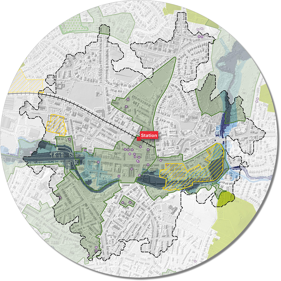
Our GIS team are able to produce bespoke maps for specific areas or to give a full national picture. Please get in touch with Steven Healey discuss our bespoke mapping system and how the NPPF may unlock a new generation of sustainable and accessible development opportunities across England, helping to support housing delivery, economic growth and investment around key transport hubs.
26 August 2026
